
Landscape and Visual Impact Assessment (LVIA)
Landscape and Visual Impact Assessment .
LVIA stands for Landscape and Visual Impact Assessment.
Systematic tool and report used in urban planning and development to evaluate how a proposed project will affect the physical character of a landscape and the views people enjoy.
The Guidelines for Landscape and Visual Impact Assessment 3rd Edition are used to provide a standardised framework to objectively evaluate how proposed developments affect the surrounding environment, making it a critical tool for planning applications and environmental impact assessments
The Landscape and Visual Impact Assessment process
Baseline assessment and feasibility studies.
Assessment of visual impacts.
Sensitivity of landscape and Visual receptors.
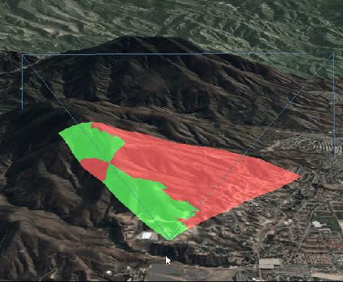
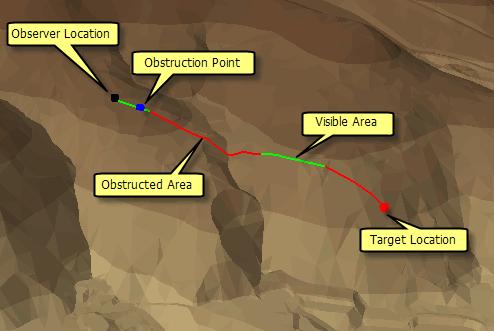
Zone of Visual Influence (ZVI.)
Photomontages.
Nature of impact.
Significance of Visual Impact.
Visual Resource Change Magnitude.
High quality 3D images.
We can deliver …
- Expert landscape and townscape planning advice to support development proposals from early concept design through to planning submission.
- Landscape and Visual Impact Assessments and Townscape and Visual Impact Appraisals — and we also provide supporting Landscape Plans and 15-year Landscape Management Plans for the discharge of conditions.
- The full range of planning contexts: residential development from single dwellings to major schemes, commercial and industrial proposals, agricultural buildings and renewable energy.
Landscape and Visual Appraisal (LVA)
Landscape and Visual Appraisal
- LVA is more suited to less sensitive contexts or for preliminary stages, providing a baseline understanding of landscape sensitivity. It can be valuable during pre-application or plan-making stages when the intention is to explore locational or design considerations before a fixed scheme is developed.
The purpose of a Landscape and Visual Appraisal is to:
- Provide a clear, concise appraisal of likely landscape and visual effects for planning submissions.
- Inform design development and embed mitigation early in the process.
- Support decision-making where impacts are expected to be limited or non-significant.
The LVA is normally required for:
- Small-scale developments
- Where planning authorities require landscape/visual consideration but not a full LVIA.
- For projects outside sensitive landscapes or without significant cumulative effects.
Landscape Character Assessment (LCA)and Townscape Character Assessment (TCA)
Landscape Character Assessment and Townscape Character Assessments are the process of identifying and describing variation in the character of the landscape or townscape.. It seeks to identify and explain the unique combination of elements and features that make landscapes or townscapes distinctive.
Key aspects include:
- Analysis of physical influences (geology, landform, drainage)
- Land cover and land use patterns
- Cultural and historical influences
- Perceptual and aesthetic qualities
- Identification of landscape character areas and types
- Assessment of sensitivity to change
Landscape Character Assessments and Townscape Character Assessments inform design and mitigation strategies, ensuring development responds appropriately to its landscape context.townscape character assessments are often described as helping clients understand the unique qualities of urban environments and providing robust evidence to support planning applications, masterplans, regeneration schemes, and environmental assessments.
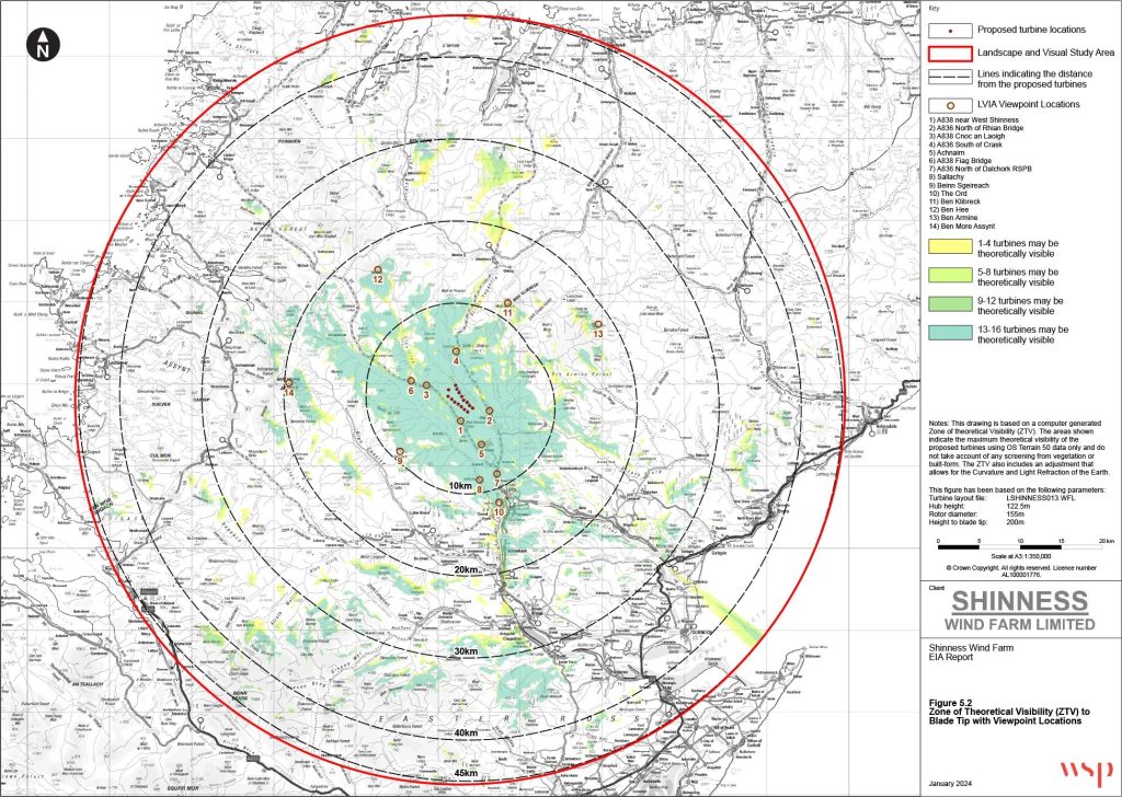
Zone of Theoretical Visibility (ZTV)
Zone of Theoretical Visibility (ZTV)
A Zone of Theoretical Visibility (ZTV) is a computer-generated map that illustrates areas from which a proposed development may be visible, based on topography and other parameters. ZTVs are widely used in Landscape and Visual Impact Assessments (LVIA), Green Belt Visual Openness Assessments, and planning submissions to identify potential viewpoints and understand visibility patterns.
The purpose of a ZTV is to:
- Provide an objective, plan-based indication of where a development could be seen.
- Inform viewpoint selection for LVIA or visual appraisal.
- Support design iteration and mitigation by highlighting areas of high visibility.
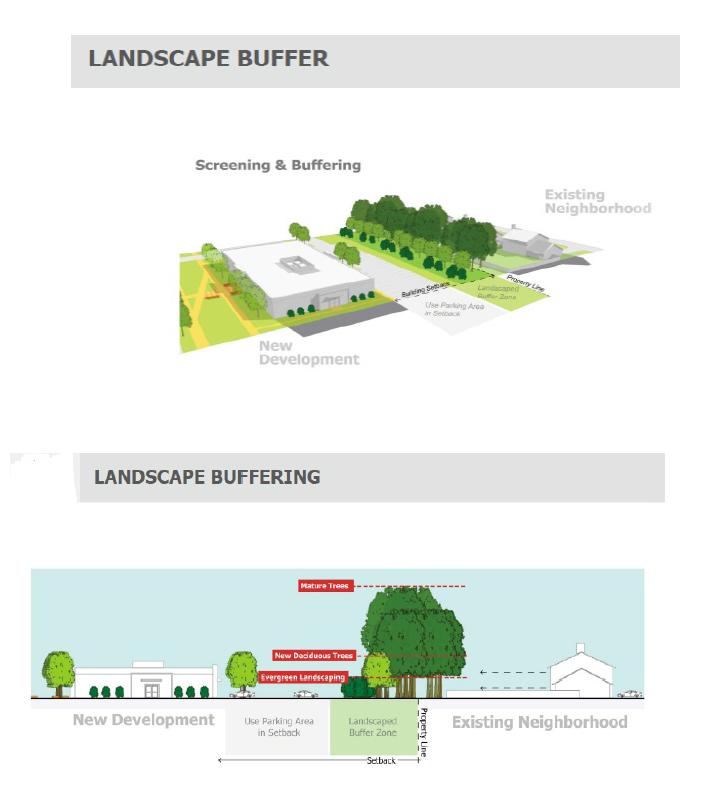
Landscape Mitigation Plans
Landscape mitigation plans within an LVIA should demonstrate how adverse landscape and visual effects are avoided, reduced, or compensated for through design, planting, landform, and management measures. The mitigation strategy is usually illustrated on a Landscape Mitigation Plan drawing and described within the LVIA.
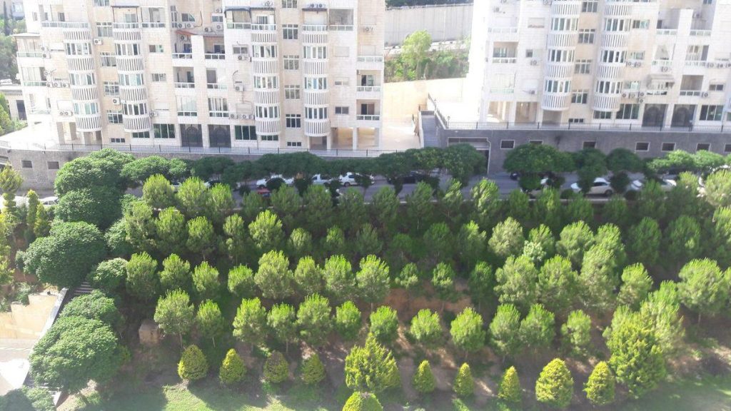
- Existing Vegetation Retention
- Structural Planting
- Landform Design
- Development Design Measures
- Biodiversity and Habitat Enhancement
- Visual Mitigation